Free Route Guide Transalpina
Transalpina
By Motorcycle
High alpine meadows and hairpin turns. Romania's highest mountain road.
By Cristi Roșu, co-founder · Updated 12 September 2026
High alpine meadows and hairpin turns. Romania's highest mountain road.
By Cristi Roșu, co-founder · Updated 12 September 2026
Transalpina (DN67C) is Romania's highest paved road, reaching 2,145 m at Urdele Pass, and unlike the Transfăgărășan it stays high for a long time: about 20 km of ridge road above 2,000 m through the Parâng Mountains, and hours of mountain riding on either side. Originally a shepherds' path called Poteca Dracului, the Devil's Path, it was rebuilt as a road under King Carol II and inaugurated in 1939, which is where the name The King's Road comes from.
The riding is intense: tight hairpins at altitude, exposed ridgelines with crosswinds, patches of broken tarmac, and sheep and horses on the road. In good conditions the surface is fine for any adventure bike. After rain the rougher sections get slippery, and this is where tyre choice and a calm throttle hand matter.
The full road runs 148 km from Sebeș in the north to Novaci in the south. From Cluj we ride it north to south, and how you come home depends on the days you have: back the same way, on through the Transfăgărășan, or east over the Strategica to the Olt Valley.
The Transfăgărășan gets the fame. The Transalpina gets the riders who come back. It is higher, longer, emptier, and on a motorbike it keeps you above the treeline for the best part of an hour instead of ten minutes. We ride it from Cluj every season, usually on the way to the Transfăgărășan, and this is the briefing: when it is open, which way to ride it, where the last fuel is, and the gravel road off the top that most people never hear about.
On the map it is the DN67C, 148 km from Sebeș in Alba county to Novaci in Gorj, crossing four counties on the way. Shepherds used the line for centuries and called it Poteca Dracului, the Devil's Path. King Carol II had it rebuilt as a road between 1934 and 1939 and drove the opening himself, which is why Romanians still call it Drumul Regelui, the King's Road. The Germans patched it up in the Second World War for military traffic, and it was finally tarmacked in a modernisation that ran from 2009 to 2015.
The top is Urdele Pass at 2,145 m, the highest point you can reach on a paved road in Romania. About 20 km of the road runs along the ridge above 2,000 m, past the peaks of Păpușa, Iezer and Muntinu, with nothing between you and the view. That is the difference from the Transfăgărășan: one is a steep climb to a single summit, the other is a long high traverse.
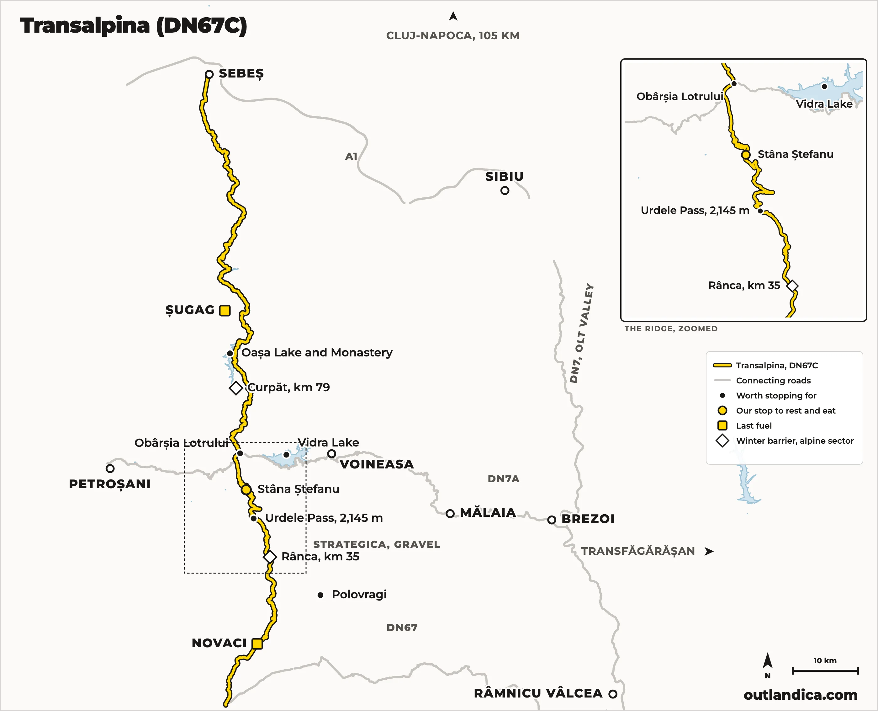
North to south, the way we ride it from Cluj: Sebeș, Șugag, Oașa Lake, Obârșia Lotrului, a plate of food at Stâna Ștefanu, over Urdele, down the hairpins to Rânca and Novaci. Open the route in Google Maps for turn-by-turn on your phone.
The high sector between Rânca (km 34+800) and Curpăt (km 79+200) closes every winter and reopens when CNAIR, the road authority, has cleared the snow. It usually comes a week or two before the Transfăgărășan: 6 June in 2025, after a late blizzard blocked the road in May, and 29 May in 2026. Both roads closed together on 20 October 2025.
In season the sector is open only in daylight. In 2026 the hours were 09:00 to 20:00 until the end of June, then 07:00 to 21:00 through July and August. CNAIR shuts it for the day whenever snow, fog or storms make it unsafe, so check the status the morning you ride. If you are on one of our bikes, ask us; we follow it through the season.
The rest of the road stays open year round. From the north you can ride to Oașa Lake and Obârșia Lotrului in any month, and from the south up to Rânca.
From Cluj it is north to south, and that is also the better way round. The northern half is a long warm-up: 70 km up the Sebeș valley through Șugag, past Oașa Lake and Obârșia Lotrului, in forest most of the way, with the road climbing so gently you barely notice reaching 1,300 m. Then the trees stop and the ridge begins. Riding it the other way, you get the drama first and an hour of forest after it.
Whichever way you come, ride the ridge twice. From Rânca to Obârșia Lotrului and back is about 45 km, and the views face the other way on the return.
Sebeș is the last town, and Șugag, 30 km up the valley, has the last fuel on this side. From there the road follows the Sebeș river through a narrow forested valley to the dams at Tău and Oașa. Oașa Lake is the stop: a long reservoir at 1,250 m with the Oașa monastery on its shore and the ridge of the Șureanu mountains behind it. The tarmac is good on this half and the traffic is light, so it is fast, flowing riding on a road that keeps opening up around each bend.
A few kilometres past Oașa the road reaches Obârșia Lotrului, a crossroads in a wide clearing at 1,300 m with a couple of cabins and a lot of parked bikes. This is where the DN7A crosses the Transalpina: west to Petroșani, east down the Lotru valley past Vidra Lake to Voineasa and Brezoi on the Olt. It is also where the Strategica leaves the tarmac. Fuel up here in the sense that matters: coffee, a stretch, and a look at the sky, because the next 45 km are the exposed ones.
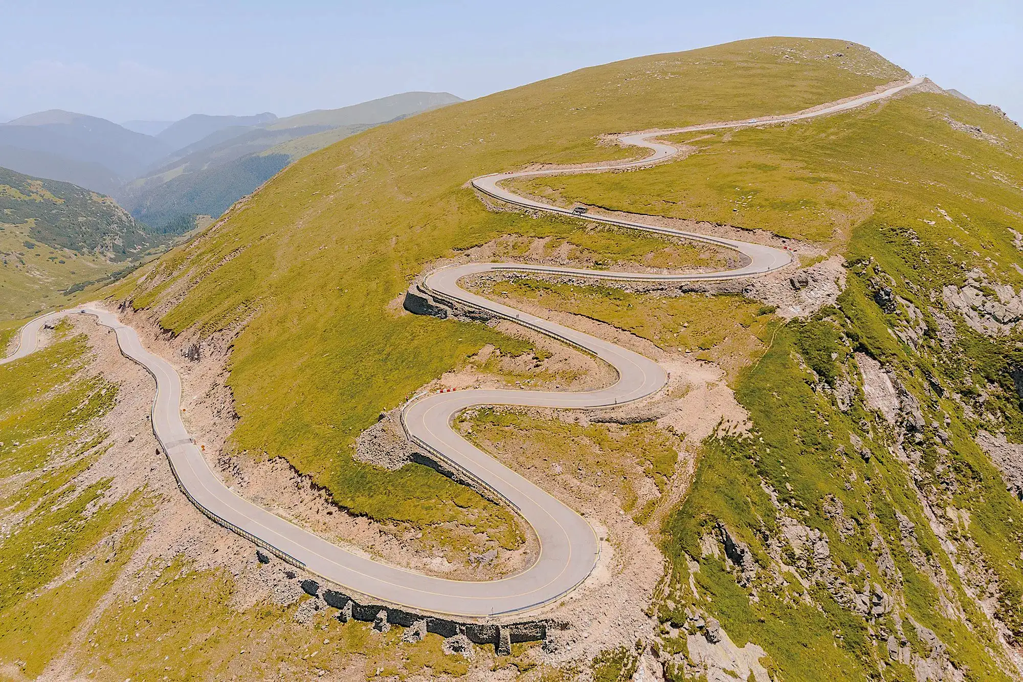
South of Obârșia the road climbs out of the last trees and onto the ridge, and it stays there. Stâna Ștefanu first, the sheepfold where we stop to eat, then Urdele Pass at 2,145 m, then the long traverse under Păpușa and Iezer with the Parâng falling away on both sides. There is no barrier on most of it, the wind is a constant, and sheep, dogs and horses treat the road as theirs. The riding is not technical. The corners are open and the sightlines are long. What it asks for is attention, because the road is old, the surface changes without warning, and the drop is real.
Then the hairpins start. The descent to Rânca stacks up switchback after switchback down the southern face, tighter than anything on the northern half, with the resort's roofs coming into view below.
Rânca is a ski resort at about 1,600 m and the busiest point on the road: hotels, roadside stalls, and on summer weekends a lot of cars going nowhere in particular. It is the place to sleep if you want the ridge at sunrise. Below it the road drops through forest to Novaci, 18 km of good tarmac with fuel and food at the bottom. From Novaci the DN67 runs east through Polovragi and Horezu towards Râmnicu Vâlcea, which is the way to the Transfăgărășan.
The Transalpina carries a fraction of the Transfăgărășan's traffic and almost none of its coaches. The pressure points are Rânca on weekends and the Urdele parking on any sunny afternoon. Ride the ridge before ten in the morning and you will have long stretches of it to yourself in any month. June and September are the quiet months, and September is often the clearest.
Nothing shelters the ridge. Wind that is a breeze in Sebeș can push a bike across the lane at Urdele, and fog comes up the valleys in minutes. Snow on the road has closed the sector in June and in September. The rule is simple: warm layers and a rain suit on the bike whatever the valley looks like, and if the top is in cloud, wait it out at Obârșia Lotrului rather than ride into it.
There is no fuel on the mountain. From the north the last station is at Șugag, from the south in Novaci, and the stretch between them is about 120 km of climbing, which costs more than the map suggests. Start full. If you take the Strategica east, the next fuel after Obârșia Lotrului is down in the Olt Valley.
The road is officially still classed as unfinished, and it shows in places. Long smooth stretches alternate with frost-broken sections, patched holes and gravel dragged onto the tarmac by run-off. Cattle grids, none. Livestock, everywhere above the treeline. The southern hairpins above Rânca have the roughest surface on the road. None of it needs off-road skills. All of it needs you to look further ahead than the corner you are in.
If you would rather not ride the Transalpina all the way down to Novaci, there is a better way off the top. The Strategica is an old military road built by the German army in the First World War, and it leaves the Transalpina near Obârșia Lotrului and runs east along the ridges of the Latorița Mountains, with Vidra Lake below on one side and the Parâng and Căpățânii ranges on the other. It is gravel and rock the whole way, and it comes down to the DN7A in the Lotru valley at Mălaia or Voineasa, from where the tarmac takes you to Brezoi and the Olt Valley.
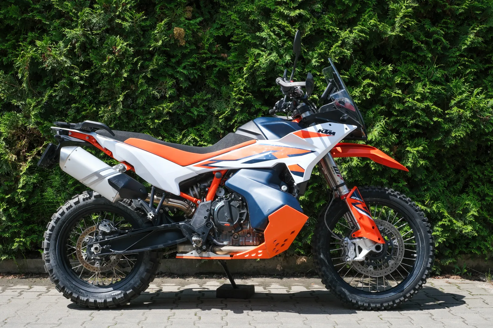
There are two ways down and they are not the same. The descent to Mălaia through the Rudăreasa valley is the easier one, a long forest road any confident rider on a CF Moto 450MT can handle. The descent to Valea Măceșului is steeper, rockier and for riders who already like this kind of thing. Both are on the Trans Euro Trail and in every Romanian overlander's track library. Our free guide to the Strategica, with the GPX for both variants, is coming next; until then, ask us for the track when you book.
It matters for the loop because from Brezoi you are on the DN7, an hour from Sibiu to the north and an hour from Curtea de Argeș to the south. Transalpina, Strategica, Transfăgărășan: three days, no road twice.
From Cluj the Transalpina is a full day: motorway to Sebeș, up the valley, over the ridge to Rânca, and a night there or in Novaci. The natural second day is east on the DN67 and the DN7 to Curtea de Argeș and up the Transfăgărășan from the south, home through Sibiu on day three. With gravel on the bike and in the rider, swap the tarmac run south for the Strategica east to the Olt Valley and join the same loop at Brezoi. Our guide to where to start a motorcycle trip in Romania lays the loop out day by day.
Urdele Pass: 2,145 m, the highest point on a paved road in Romania
About 20 km of ridge above 2,000 m through the Parâng Mountains
Oașa Lake and the Sebeș valley: 70 km of forest and water on the northern half
Obârșia Lotrului: the junction for Vidra Lake, the Olt Valley and the Strategica
Rânca: the ski resort at 1,600 m where the southern hairpins begin
Optional gravel over the Latorița ridge on the Strategica, the old military road
In season, yes: the high sector between Rânca and Curpăt is usually open from late May or early June until late October, in daylight hours only. CNAIR, the road authority, can close it for the day for snow, fog or storms, so check the official status the morning you ride. If you are on one of our bikes, message us; we follow it through the season.
There is no fixed date. CNAIR opens the Rânca to Curpăt sector once the snow is cleared, usually a week or two before the Transfăgărășan: 6 June in 2025, 29 May in 2026. It closes with the first serious snow, on 20 October in 2025. In season the sector is open roughly 09:00 to 20:00 in early summer and 07:00 to 21:00 in July and August.
The DN67C runs 148 km from Sebeș in the north to Novaci in the south. The high mountain part is the 45 km between Obârșia Lotrului and Rânca, over Urdele Pass. From Cluj-Napoca you start at Sebeș, about 105 km down the motorway.
North to south if you can. The northern half is a long, gentle climb through forest past Oașa Lake, and the ridge arrives as the reward. From the south you are on the switchbacks and the ridge within half an hour of Novaci, and the forest comes after. Either way, ride the ridge between Rânca and Obârșia Lotrului in both directions; it is only 45 km and the views change.
About three hours of riding for the full 148 km without stops, and a day in practice: Oașa Lake, Obârșia Lotrului, the photo at Urdele and Rânca all eat time. From Cluj it is a full day there, and most riders sleep at Rânca or Novaci.
Ride both, they are different roads. The Transfăgărășan is steeper and more theatrical, one big climb through the switchback wall to 2,042 m. The Transalpina is higher at 2,145 m, stays above the treeline for about 20 km instead of two, and carries a fraction of the traffic. From Cluj they link into a two or three day loop.
No. The last stations are at Șugag on the northern side and Novaci on the southern side, about 120 km of mountain apart. Nothing at Oașa, Obârșia Lotrului, Urdele or Rânca. Fill up before the climb, and if you take the Strategica east, count on nothing until the Olt Valley.
Exposed. The ridge has no shelter, the wind at Urdele can push a bike across the lane, and fog fills the valleys in minutes. It has snowed on the road in June and in September. Carry warm layers and a rain suit however the valley looks, and wait out low cloud at Obârșia Lotrului rather than riding into it.
It is not technical, and a careful beginner on any motorbike can ride it. What catches people out is the combination of an old surface that changes without warning, no barriers on the ridge, crosswinds, and livestock on the road. Look further ahead than the corner you are in, keep the speed honest, and it is a long, safe day out.
An old First World War military road that leaves the Transalpina near Obârșia Lotrului and runs east on gravel along the Latorița ridge to the Lotru valley at Mălaia or Voineasa, and on to the Olt Valley at Brezoi. It is the way off the top for riders who would rather not ride down to Novaci, and it is on the Trans Euro Trail. Two descents, one easier and one harder; our free Strategica guide with the GPX for both is coming next.
The guide is yours to use. Rent a bike in Cluj-Napoca, 20 minutes from the airport, and ride the road at your own pace.